The new objectivity: photographer Max Sher’s alternative guide to Russia
With his latest project, Russian Palimpsest, photographer Max Sher aims to capture everyday life in Russian cities. Inspired by the Düsseldorf School of Photography's neutrality of expression, Sher's goal is to create a new and objective visual language for Russia
18 March 2014
Text and image
Max Sher
I was born in St Petersburg and remember well how as a kid I used to roam the area where my grandparents lived. I had a Soviet map of the city, which was deliberately inaccurate. A number of streets were missing from the map including the one where my grandparents’ house stood. It should be said that detailed city maps were hard to come by during the late Soviet era and so I took it upon myself to put the missing streets on my map. I was constructing, unconsciously, my own map and mental image of the city, and by doing so, symbolically defying the erroneous version imposed on me by the state.
This idea is one of the two key concepts behind my latest project, Russian Palimpsest. The first is to make my own photographic “map” of Russia and create a visual catalogue of our post-Soviet territory. The second is to contribute to a new visual language. Russian Palimpsest, an ongoing photographic project, looks at the everyday visual culture of cities that are still making the transition from the communist utopia of the Soviet era towards a homegrown version of consumer capitalism. The images in the collection take in a range of influences, from 19th-century Russian landscape paintings and Soviet-era postcards to Google Street View, all of which contribute to the visual language through which Russia is made sense of today.
People of my generation — I am 38 — and older might remember the huge Map of the Soviet Union made of around 45,000 precious gems. Originally crafted for the 1937 Paris World Expo, it was eventually installed where the tsar’s throne once stood in St George’s Hall in the Winter Palace in St Petersburg. The map was a powerful symbol of control over the visual representation of the territory. Creating inaccurate geographical maps was just one element of wider efforts to use various artistic tools, such as photography, to project an image of Soviet vastness and greatness. Given that travel and photography would undermine this myth, it isn’t surprising that both were severely restricted during this time.

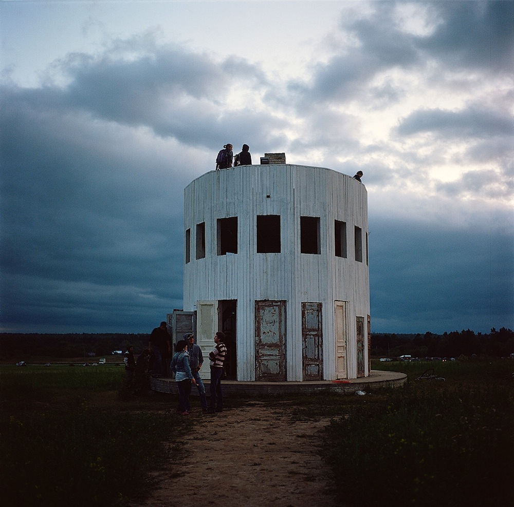
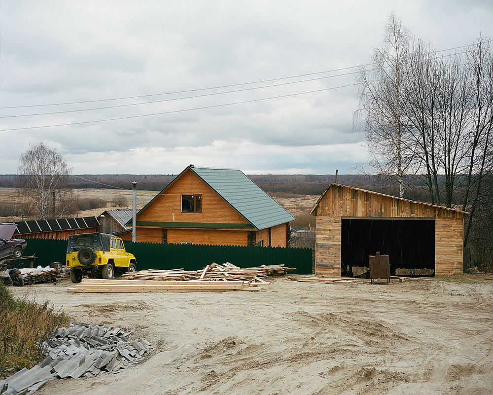
Makariev (31 October 2013), 57°52′13.54″N, 43°47′43.49″E. Click here to view the full gallery.
Russia is still at a loss for a dispassionate visual representation of its territory. During the Soviet period, official photography produced feel-good images that obscured reality. In contrast, the unofficial, “democratic” photography that emerged during the last two decades of the Soviet Union focused on portraying the darkest sides of reality in a bid to lift the lid on the so-called truth. In both cases, few were interested in recording the landscape with a detached, scientific eye.
My aim is to rectify both biases in order to aestheticise that which is considered “ugly” in the Russian landscape (thanks in part to those democratic image-makers) and help it enter our consciousness. It’s nothing new if we think of what the pre-1917 Russian photographers looked at and photographed. Before the Russian Revolution, postcards featured photographs of prisons and poor neighbourhoods. Yet they were photographed in an “objective” manner.
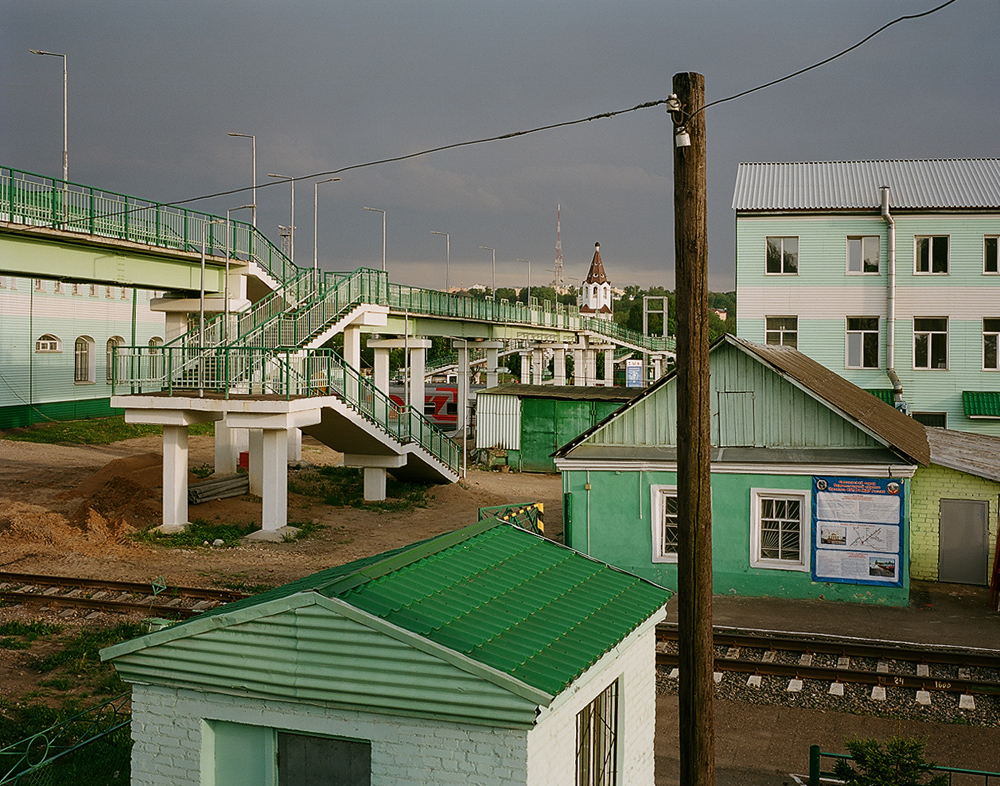
Smolensk (17 May 2013), 54°47′57.35″N,32°2′12.49″E. Click here to view the full gallery.
The point is that this is what Russia looks like so we should learn to accept it, prisoners and all, and reclaim these images as our own. I want to inspire a shift from the sublime and the dramatic to the everyday — the petrol stations, bridges, warehouses, railway crossings, shopping malls and yes, the prisons. I want to explore, record and accept all this in its entirety and so, I have adopted the deadpan aesthetic conceptualised in the 1950s by a group of German and American photographers who would later come to be known collectively as the New Topographics and the Düsseldorf School of Photography.
It is necessary for the post-Soviet individual to reclaim even the most basic of rights such as the right to look at one’s own country from a private perspective. In this sense, my photographic exploration also involves the privatisation of the viewpoint. I especially feel it when I photograph from up high, say, from a bridge; something virtually unthinkable as little as 20 years ago when landscape photography was impossible as a subject in its own right.
All the photographs in my project are captioned with the name of the place, date and exact geographical coordinates, suggesting an open-ended diary-cum-catalogue of our time and living space. The coordinates can easily be copied and pasted into a web mapping service, which serves to realise the unbreakable connection of the image of our contemporary landscape and the media space.